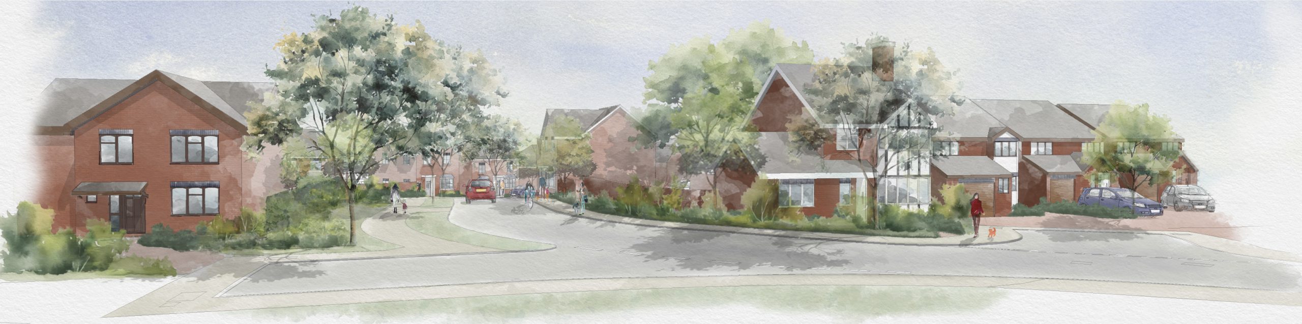
Illustrative view of the proposed site entrance
Our Proposal

156 high quality open market and affordable homes to support local housing need ahead of the adoption of the Local Plan where the timescales are uncertain
New vehicular access route via The Glebe, linking to key transport routes

Connection with the wider public rights of way network

New, accessible areas of open space including a central play area and two smaller informal play areas

Enhanced and managed open space, including new planting and sustainable urban drainage to encourage wildlife and biodiversity

Opportunity to provide linkages to future developments to the south and east.
The Masterplan
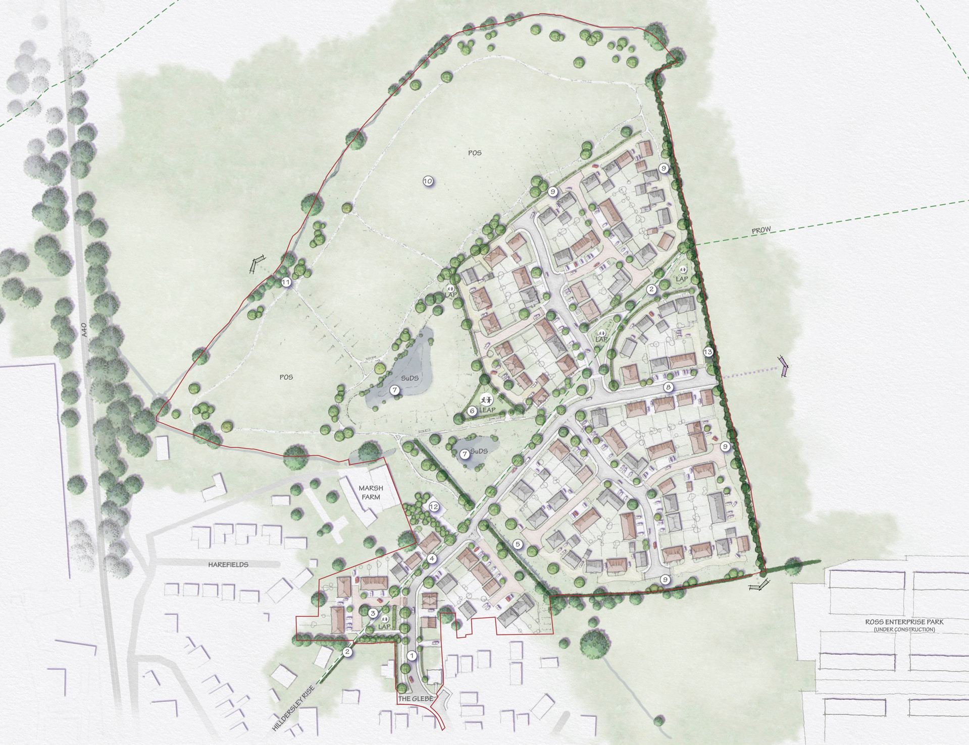
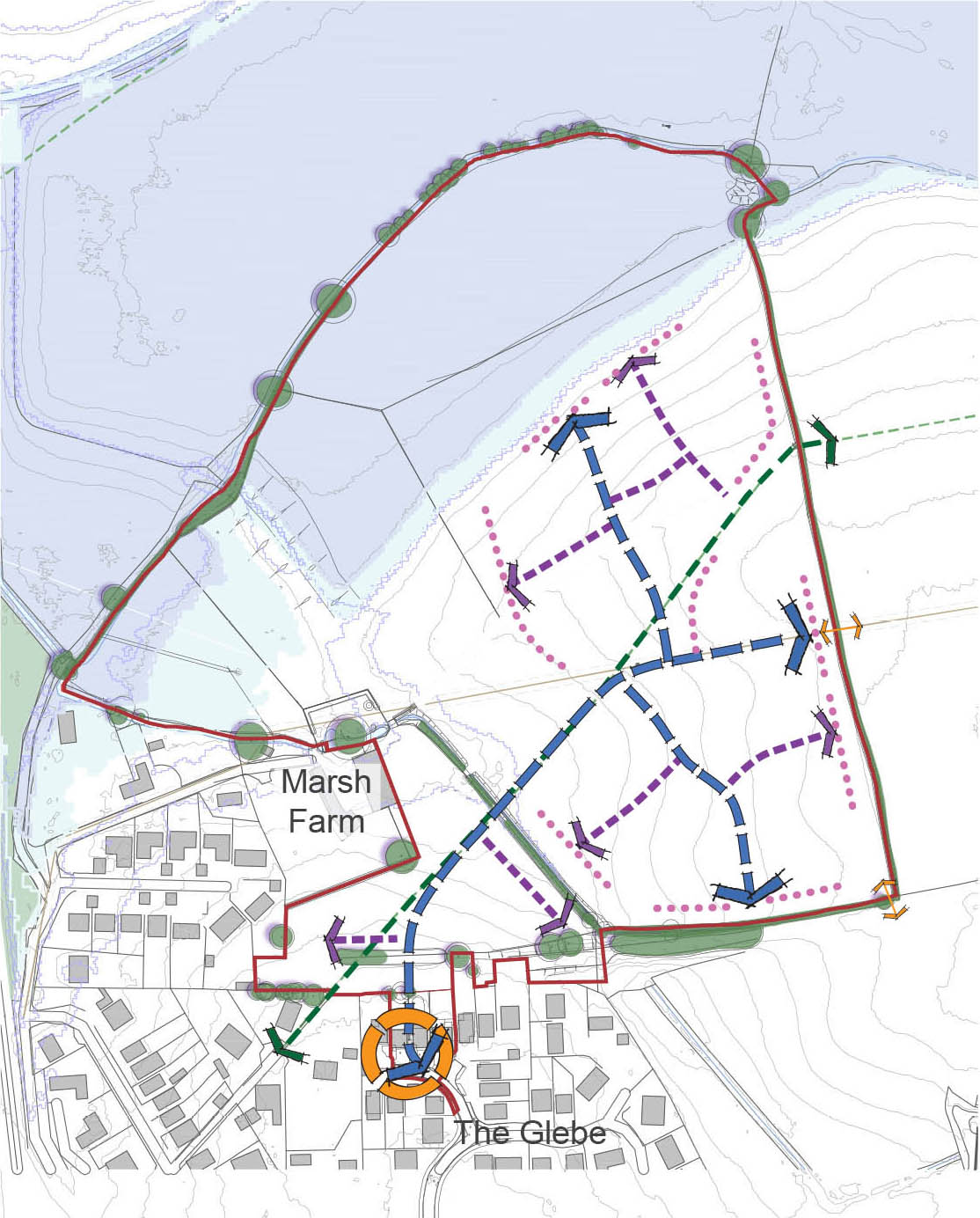
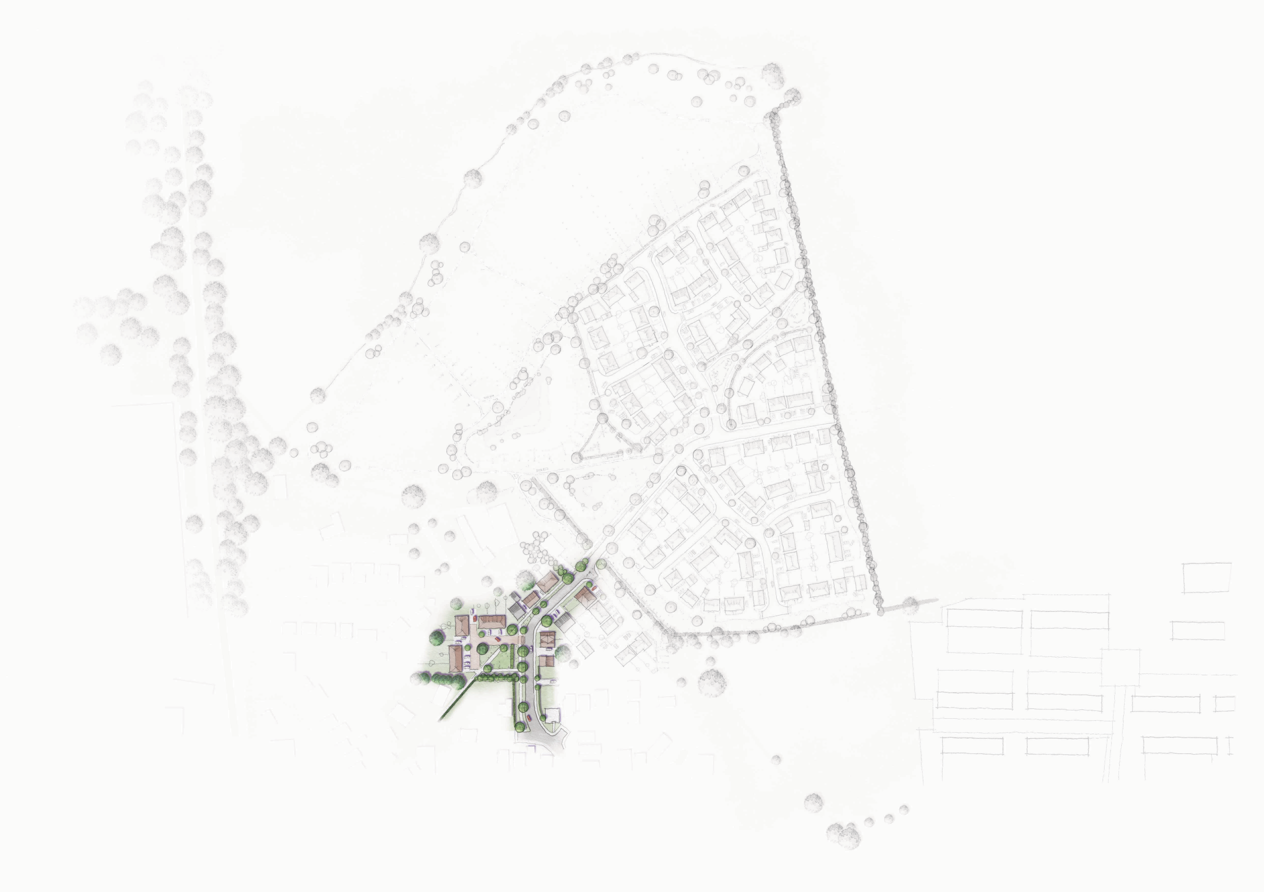
The Illustrative Masterplan above shows the proposed layout for this site.
- A new vehicle access would be constructed via The Glebe. No’s 8 and 9 The Glebe would be demolished to enable a new connection to the existing road network.
- An existing Public Right of Way (PRoW) extends across the site from Hilldersley Rise in the south-west corner and links to the wider footpath network to the east. This route would be protected and integrated into the proposed development with Local Areas for Play (LAPs) incorporated along the walking route.
- This welcoming area of public open space would define the entrance to the site, benefitting from natural surveillance by surrounding housing and including an informal play area (Local Area for Play), trees and hedge planting.
- A ribbon of open space would be retained and enhanced with tree planting alongside the existing Public Right of Way (PrOW).
- The existing ditch and hedgerow would be retained and enhanced with additional trees. A short section of the ditch would be culverted to enable the proposed access road crossing.
- A centrally located equipped play area (LEAP) would benefit from good natural surveillance provided by the surrounding buildings and close to both the existing PRoW and proposed pedestrian routes.
- Two surface water attenuation basins (SUDS) would be integrated into the public open space. Gently sloping positioned embankments leading to a flat grassed base would be positioned closest to the play area to promote safe use and interaction with the basins.
- The primary access road would be located over an existing foul sewer and could provide links with any future development to the east.
- Active frontages would overlook the areas of Public Open Space to the north and north-west.
- The lower northern part of the site sits within Flood Zone 2 and 3 so this area would be safeguarded as Public Open Space, with informal footpaths, seating and ecological enhancements.
- Potential pedestrian link to the north.
- Indicative Foul Water Pumping Station location
Design principles
Access and Transport
Vehicular access and pedestrian access would be via The Glebe at the south-western side of the site. This would require the removal of two properties (nos. 8 and 9) on The Glebe to facilitate access. We acknowledge this will be a significant change for residents of The Glebe, and welcome the opportunity to discuss ways to minimise this impact.

CGI illustration of proposed site entrance
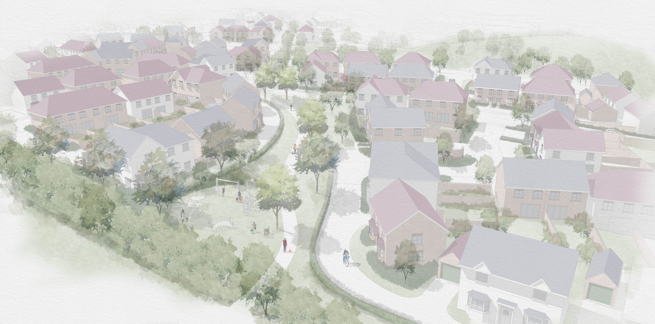
The housing would be served by a hierarchy of primary and secondary streets, which would serve private/shared driveways around the periphery.
Footpath access to the wider Public Right of Way (PRoW) network would be retained, with the line of the PRoW retained in its current alignment. There is potential to create new links to future development to the south and east of the site.
Housing Design
The detailed design will be further developed at the later reserved matters stage, but the principles are:
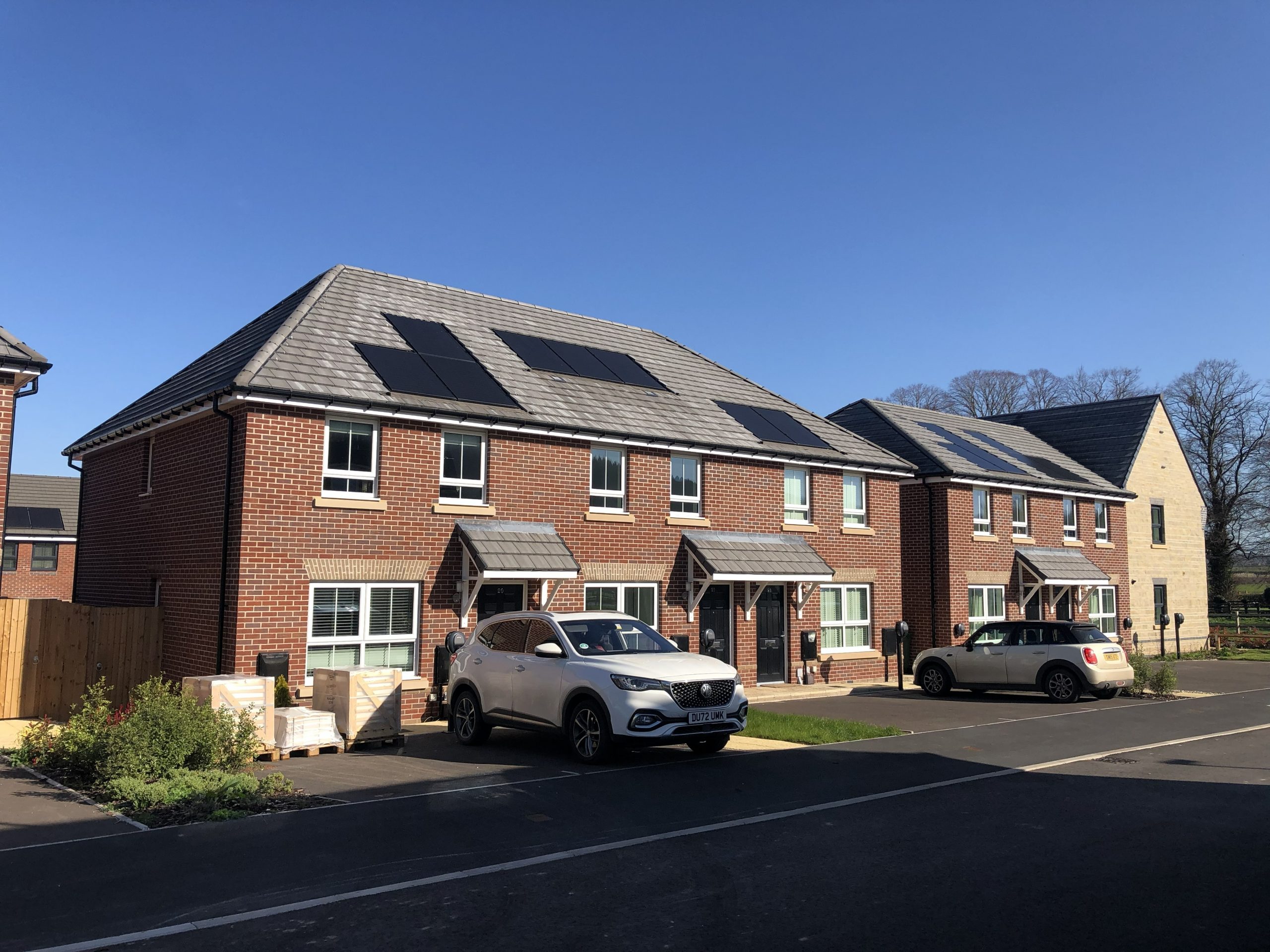
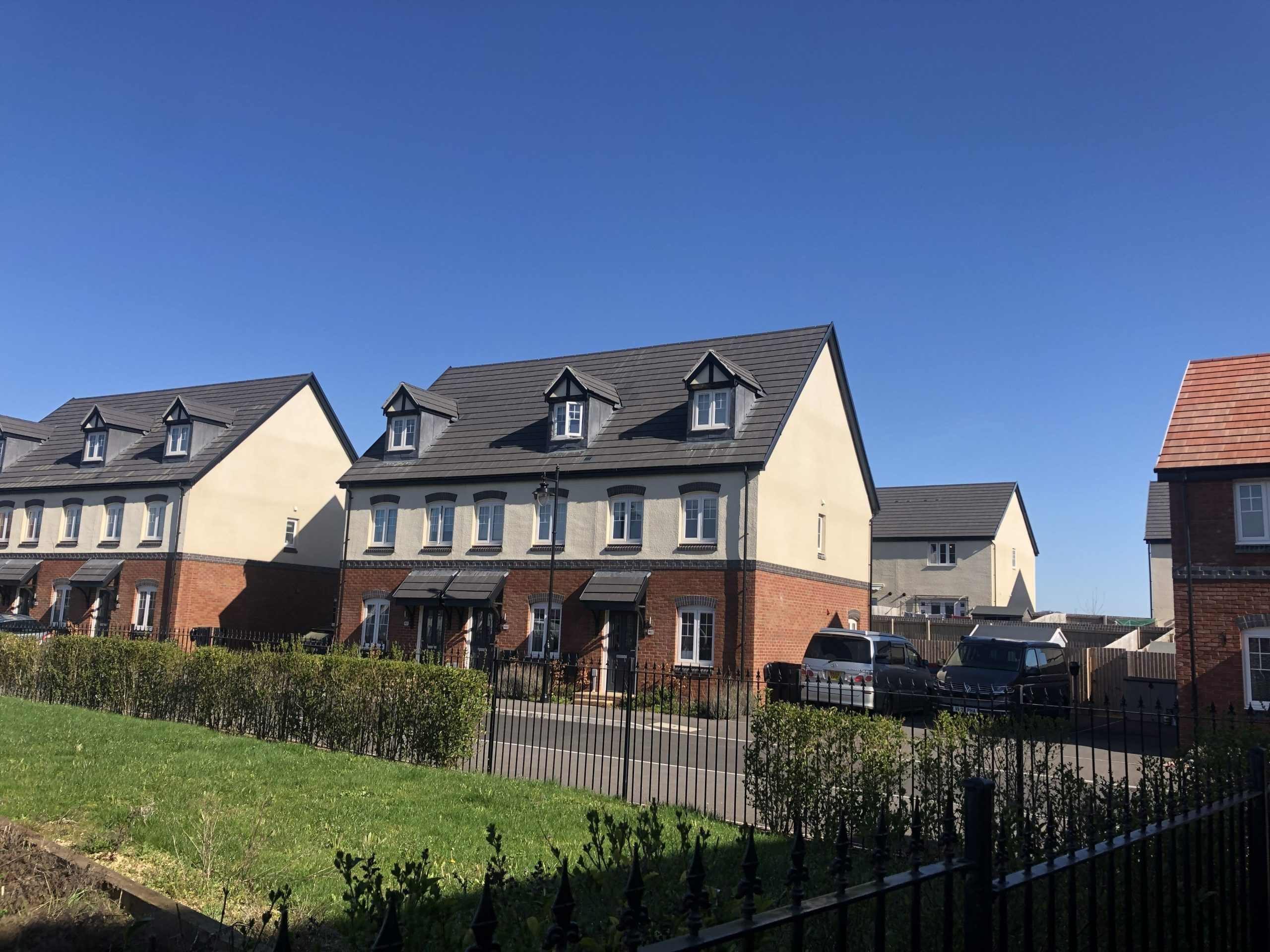
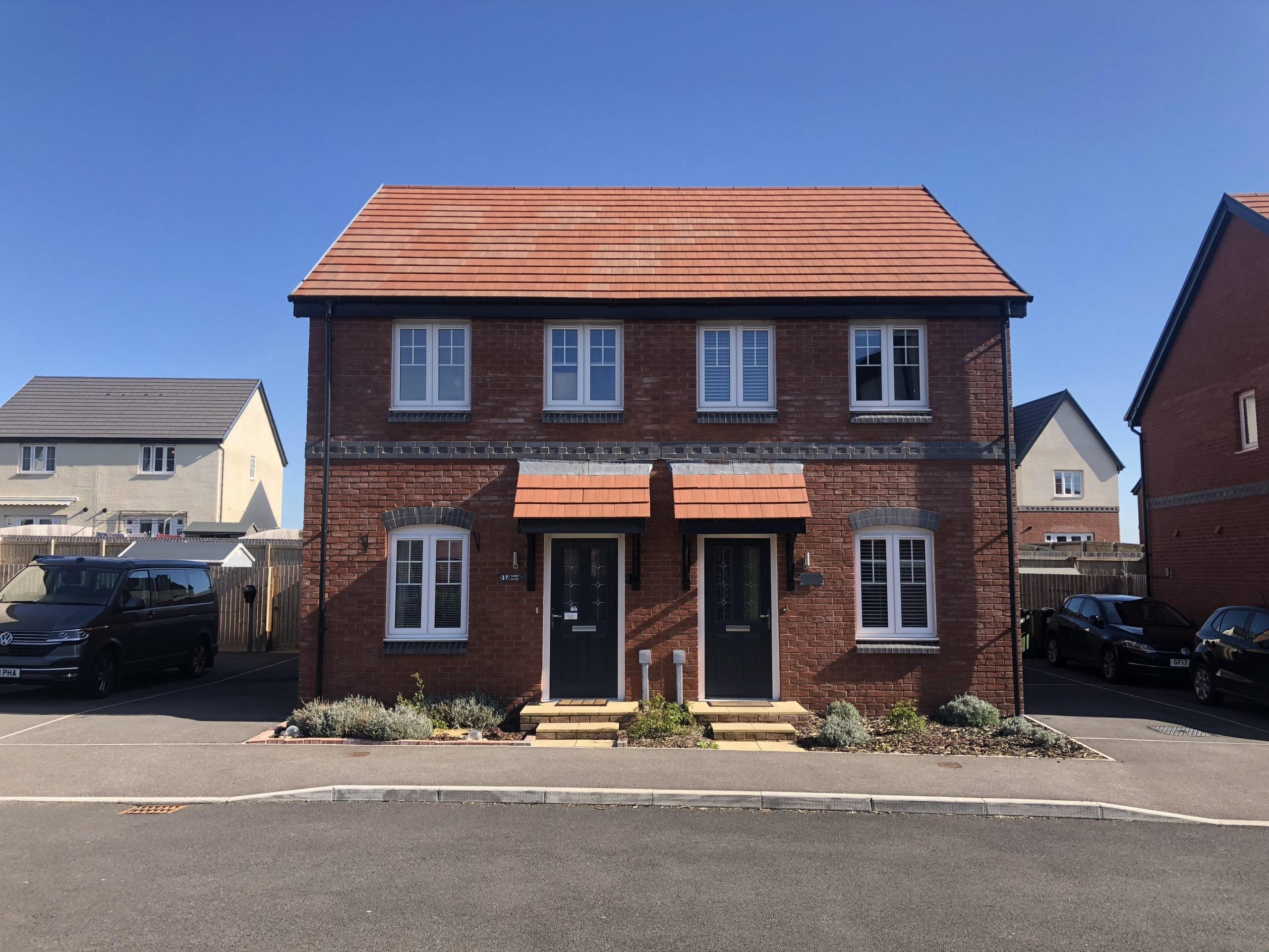
- Homes to be up to 2.5 storeys in height. The proposed housing located closest to existing residences will be up to two storeys.
- Key character areas to create a sense of place and identity unique to this development.
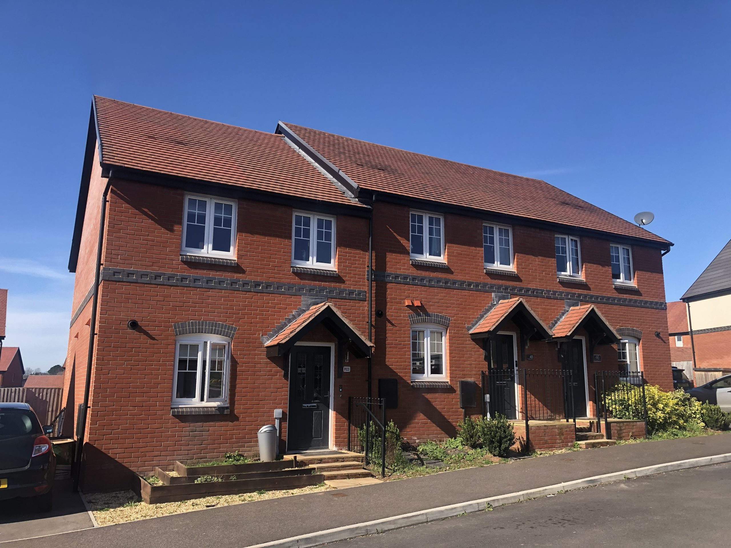
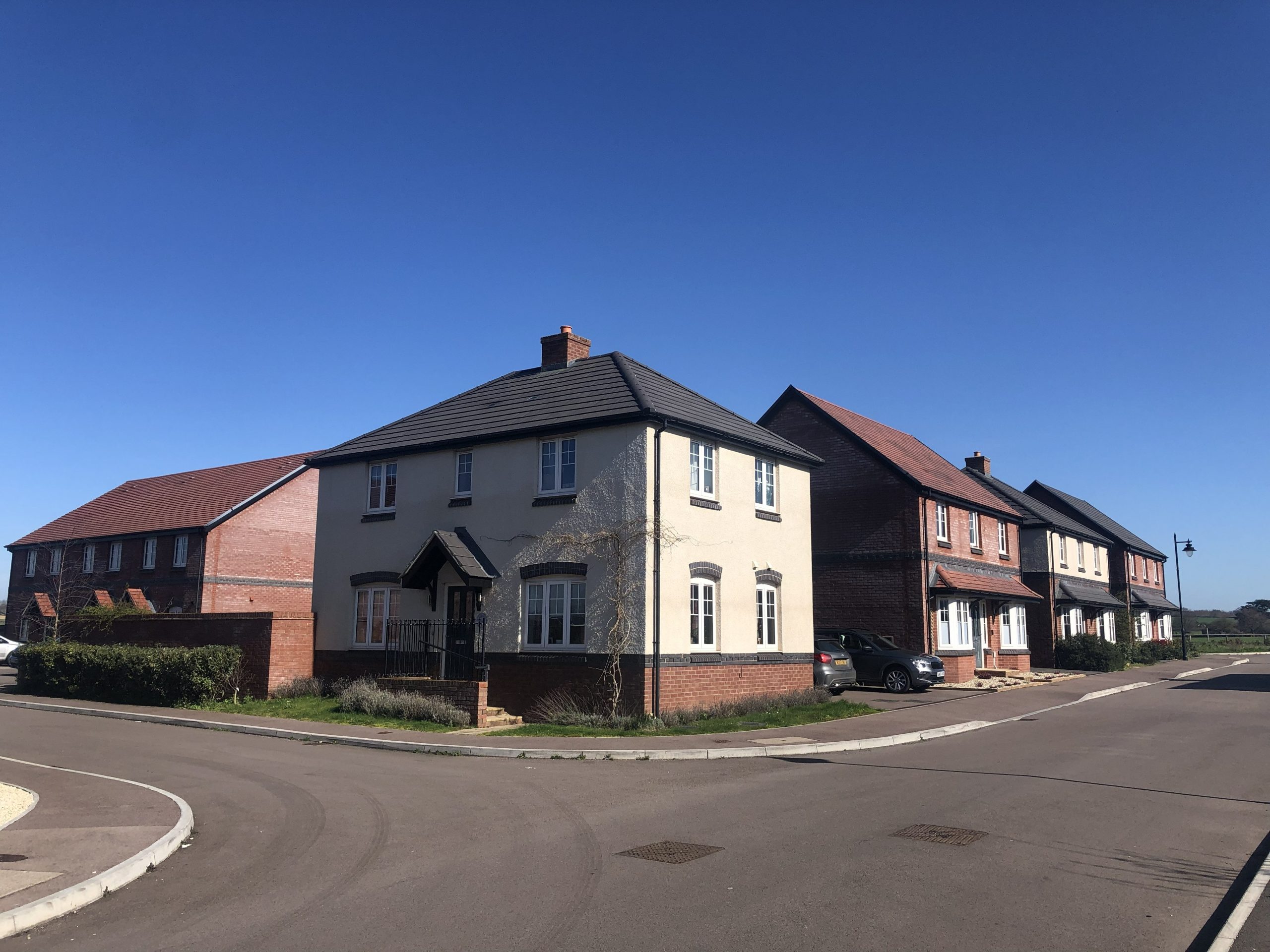
- Materials to respond to local precedent and emphasise red brick and white render in building elevations.
- Roofscape to comprise a mix of grey and red/brown colours to provide variation.
The precedent images below are from nearby recent developments and provide a guide as to the appearance that the proposed development could take, emulating period features found within Ross-On-Wye.

Ecology and Biodiversity
This site offers a valuable opportunity to create a development that not only protects existing wildlife but also improves local biodiversity. By carefully assessing the site, putting the right safeguards in place, and creating new habitats, the proposals can deliver a net positive outcome for biodiversity and fully align with national and local planning objectives.
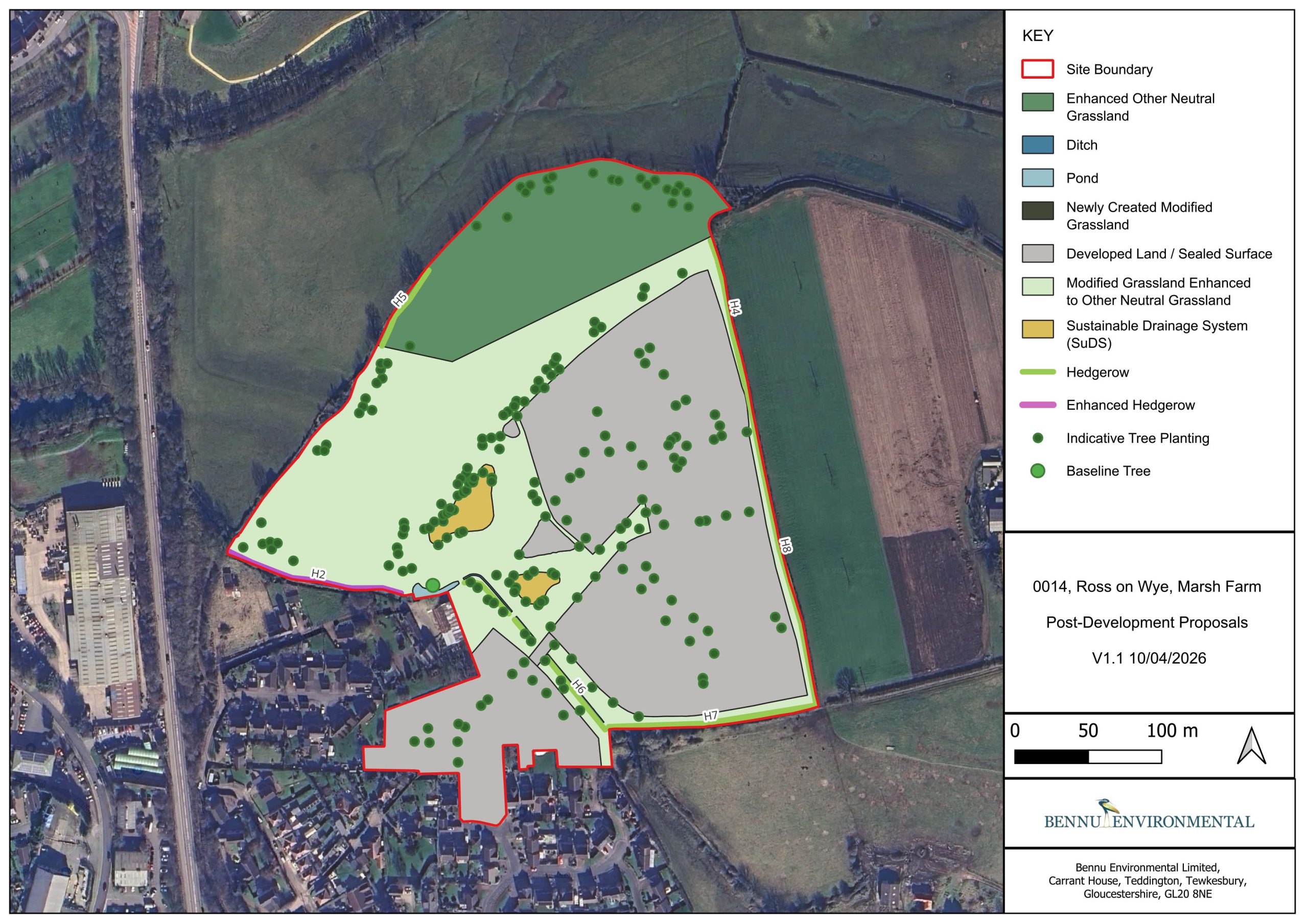
The vegetation around the edges of the site will be kept and improved, and the majority of the existing trees and hedgerows will be included in the final layout as essential features that add to the character of the area.
New groups of trees will be planted to reduce the visual impact for people walking along the public footpath that follows Rudhall Brook to the north.
The poor quality fragmented hedge running through the centre of the site would be removed to facilitate development, but new hedge planting would be introduced around the northern edge of the site.
Character Areas
The proposed development features the following key character areas, which would create a sense of place and identity unique to this site.
The entrance
- Welcoming green open space on arrival to the site
- Existing Public Right of Way (PRoW) retained within open space
- Homes orientated to provide natural surveillance across the entrance space
- Large street trees within open space and along roadside verge
- Local Area for Play (LAP) integrated into open space
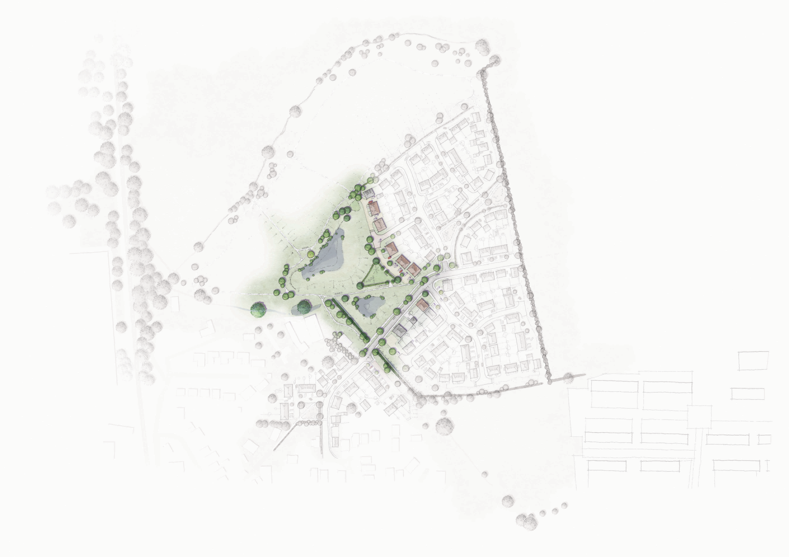
Sustainable Drainage Systems (SuDS) and play area
- Homes orientated to enjoy views over SuDS area and provide natural surveillance across the space
- Play area (LEAP) integrated into the space
- SuDS basins designed with varying gradient side slopes, to enable safe access and invite use
- Permanent pond areas could be included
- Informal pathways and seats provided
- Tree planting to frame views towards St. Mary’s Church Spire
- Existing ditch and hedgerow retained

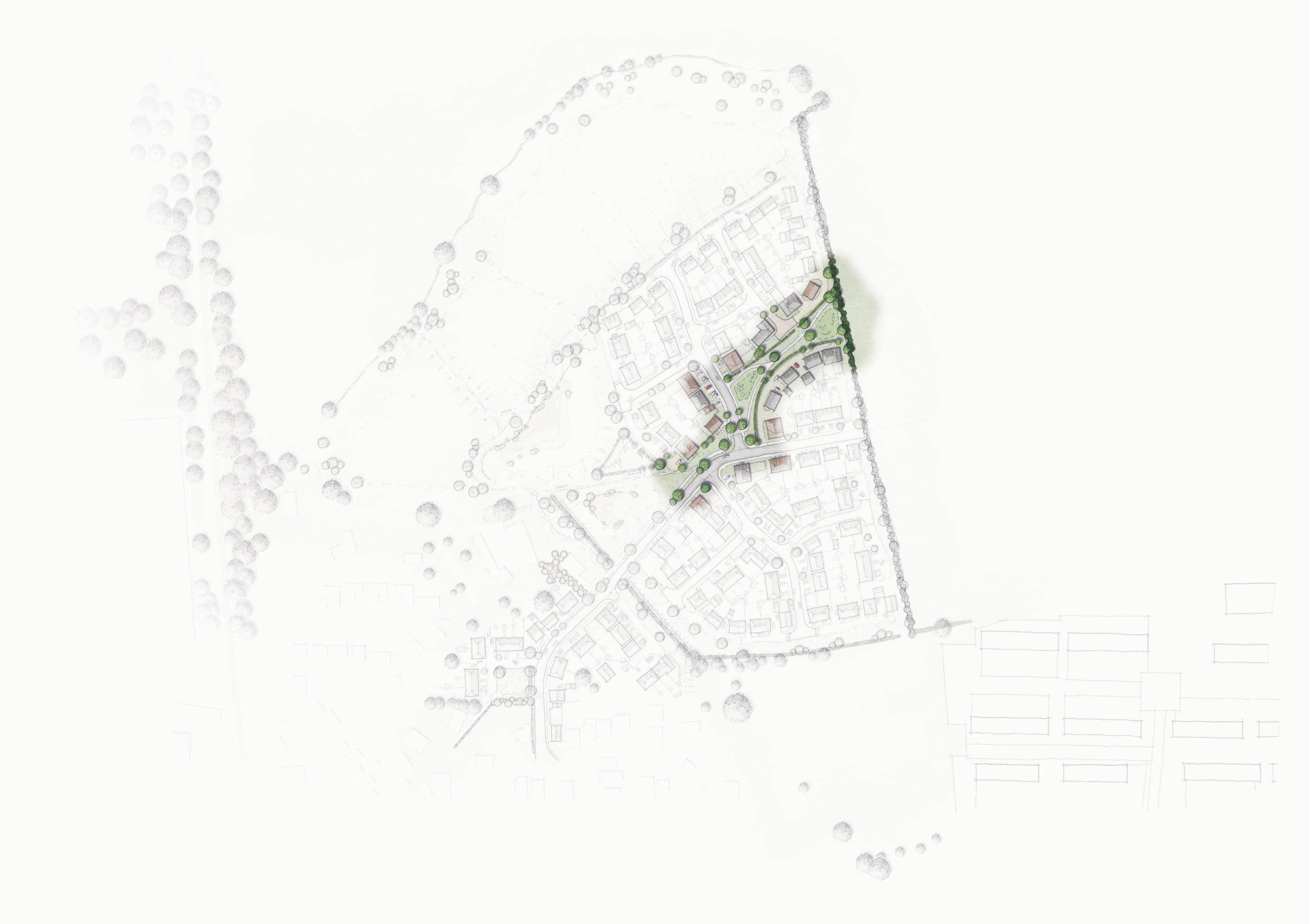
Green Corridor
- Ribbon of open space extending through the site, following the route of the existing public right of way (PRoW)
- Meandering footpath provides pedestrian route through the site and on to the wider PRoW network to the east
- Small play areas (LAPs) to be incorporated along the walking route
- Homes orientated to provide an active frontage and natural surveillance
- Large tree planting including climate and disease resilient species
- Low level hedge planting
- Limited vehicle movements

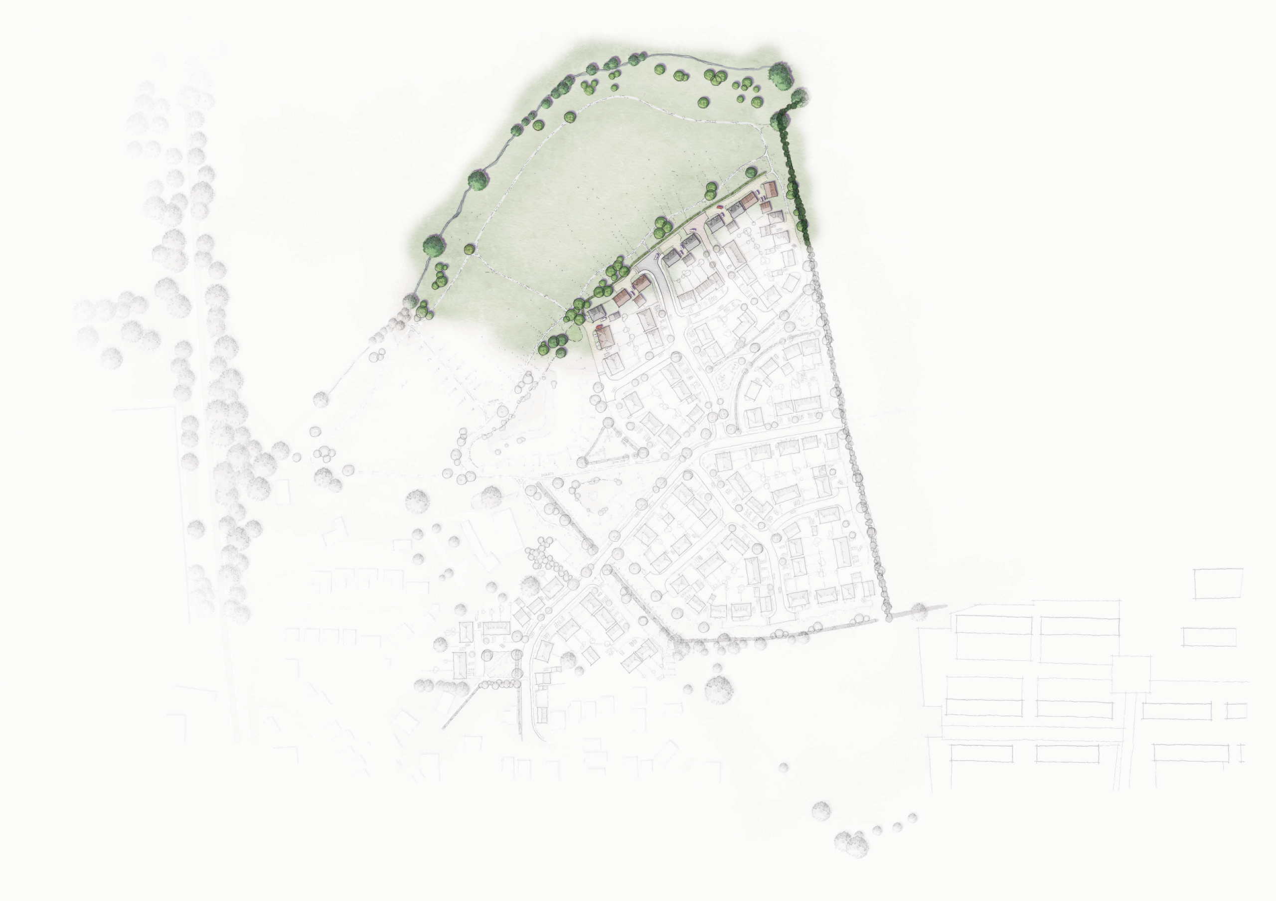
Flood Zone and Public Open Space
- Homes orientated to enjoy views and provide natural surveillance over the open space views of the development
- Low level hedge planting provided along development edge
- Vehicle movement limited to private shared drives
- Grassland to be enhanced to ensure a net gain in biodiversity
- Informal footpaths and seating provided throughout the open space


Get in touch
If you have any questions, you can:
- Submit them via the feedback form
- contact@landra-newhomes-ross.co.uk